 |
| In several spots we had to negotiate around trees overhanging the canal being careful to not hit a snag or run aground. |
 |
| We weren't always successful in avoiding the branches. Better to trim trees rather than hit a stump or shoal. |
 |
| Handy chart along the way. By the time we finish our trip, we'll have covered every mile posted. |
 |
| Our boats tied up at a free wall outside of lock 2. A convenient grocery store across the street made this a perfect spot to layover a night. |
 |
| An old dock along the canal. When it was a commercial venture, there were many small settlements along the canal with mills, stores and towns full of people. |
 |
| Another sense of humor. We saw this figure on a dock from the distance and wondered what he was doing. |
 |
| More shades of greens. |
 |
| This is the back of the welcome sign welcoming southbound boat to North Carolina. |
 |
| The canal also had these handy mile markers helping you keep track on paper charts of your location. |
 |
| Viny art. This is one old vine. |
 |
| A destroyed still. |
 |
| There can be no wake along the entire stretch of the canal. Wake does dislodge plants along the canal and erodes the bank. |
 |
| This was once the site of a thriving lumber mill town. |
 |
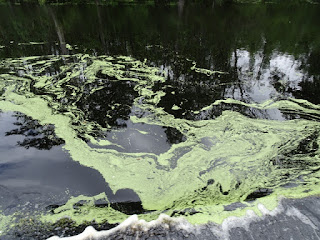
| More pollen art. If you click to enlarge the picture, you can see how chocolate the water in our bow wave looks. |
 |
| Eyes on the chart to keep us afloat! |
 |
| Our path cut through the thickest part of the pollen. |
 |
| This kind of snag was a constant concern for us. I'd never navigate the canal in the dark. |
 |
| Cypress soaking up the water. |
 |
| Charts were essential since there were so many false routes and side creeks that looked as large as the canal at their mouths. |
No comments:
Post a Comment